Today I finally hit the Trail of the Coeur d’Alene’s. This trail is a paved route that runs from the town of Plummer ID on the western edge, to the town of Mullan on the East. The Trail is 73 miles long if ridden from Plummer to Mullan. After riding 3 days straight, and without a support car to pick me up in Mullan, I decided that the wise course here was to split the trail into 2 installments. Today I rode the western section (26 miles of it anyway), and on Saturday I will ride the last part of the eastern end. On the east side, there is a long ascent to Mullan that starts in the town of Kellog and passes through Wallace with the trail (but not the mountain) culminating in the trailhead at Mullan. But enough about tomorrows planned ride. This is about today.
I woke again at 6AM (Oddly I am on vacation and am waking up considerably earlier than I do for work), and after a quick shower headed down to the breakfast buffet. Biscuits and Gravy alongside scrambled eggs was my fuel for today (and a small muffin). After breaking my fast, I geared up and hit the road to Plummer.
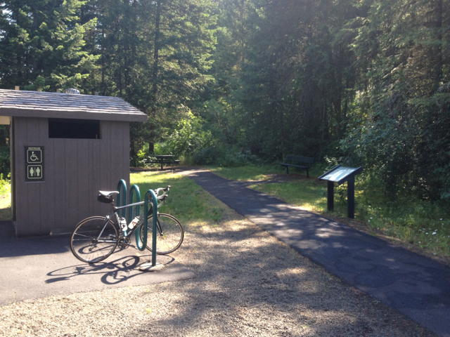
Plummer is about 48 miles south on Hwy 95, so the drive was easy, but locating the trailhead was not (for me at least). I was looking to the left of the road when I got near to Plummer for an indication of the trail since I knew it ran east. As a result, I must have missed whatever sign there was pointing me to the actual trailhead on the right side (west side) of the road. Shortly into Plummer, i did see a sign indicating that Hayburn State park was down a road to the left, and that there was a tourist information center there. I headed down that road, and to the park information center. This ended up being a great choice. As I neared the park entrance I saw signs indicating the Trail of the Coeur d’Alenes was that way, so following the signs brought me to the park office. Once in the office I was able to purchase a day parking pass and was directed to a parking log 2.5 miles away where there was a trailhead.

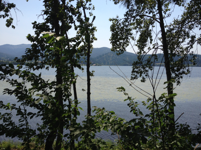
Panning shot of the view from the trail
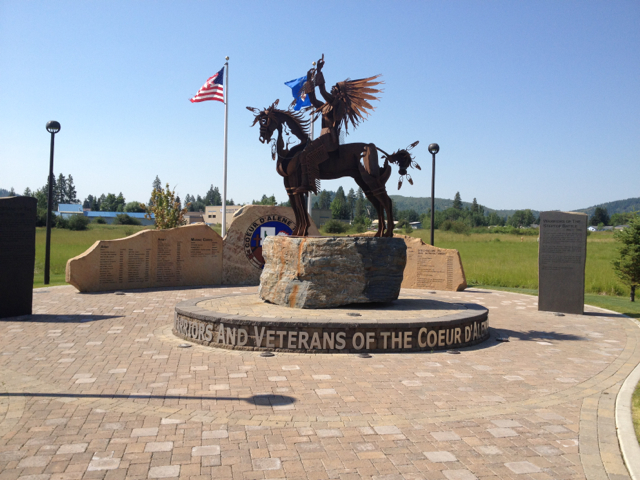
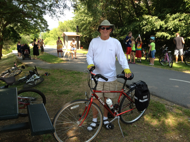
I parked, pulled out my gear and hit the trail. This is where I made my second fortunate mistake. When I hit the trail, I went right instead of left since the trail to the right had trees and a slight incline. This turned out the be fortunate since the trail in that direction was in the direction of the Plummer trailhead. I road the 7.5 mile 3% grade up the trail to the Plummer entrance, getting to see some beautiful flora and of course riders heading down hill from the Plummer entrance. I hit Plummer, stopped to check out the memorial then turned back to descend the same 7.5 mile trail back to where I began. This was an awesome way to start the day since it got the climbing out of the way at the start, and it would be less likely that if I had postponed that section to ride it at the end of my day I would have skipped it, or shortened the ride to conserve strength. As it was, I was able to commit myself more fully and push a little farther knowing that the entire remaining ride was flat.
See my ride for the day.
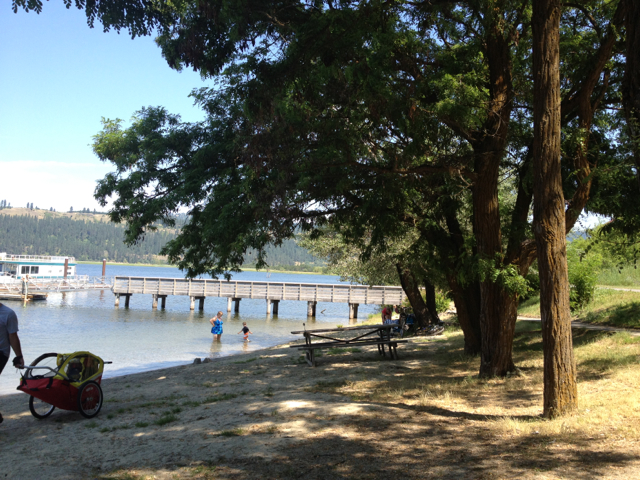
The next section of trail was to the town of Harrison on the lake. Getting to Harrison meant riding over a bridge spanning the section of the lake where the park was located. This was a cool bridge to ride. It consists of a short climb up to a section high enough for the steam boats that used to ply the lake to pass under, then descend back to lake level. The incline sections are made of short stages similar to if you took wide stairs and connected them with small curvy ramps. The view from the top of the bridge of the lake was great. After the bridge, the rest of the 9 mile section to Harrison hugs the lake, passing through sections where private homes exist on one side, and private docks on the lake side. A variety of flora and fauna can be seen throughout the trail. I this particular section I rode about 6 feet from a grazing deer on my return trip.

I got to Harrison in good time. Since this is a tour, I kept the speed low, trying to stay under 15mph as much as possible. Even so I ended up startling one pair of women cyclists who were cruising side by side on the trail. They hadn’t seen another rider for awhile, and when I called out that I would like to pass on the left, they both jumped a little. We all had a laugh at that, and I headed on to Harrison. In Harrison there is a lille bike “shop” where if you are very desperate you could probably get a quick repair. I didn’t stop there, but I would guess that most of their business is in tubes. I took a break in Harrison for about 5 minutes, then continued on to the next town down trail 11 miles away.
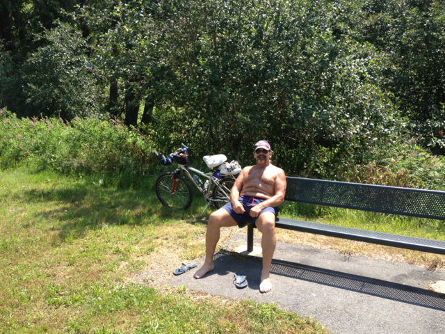
Shortly after leaving Harrison, I came across what I initially mistook to be a statue, but when I got closer found out that it was in fact Mike. Mike is a local resident of the town of Worley ID, about 6 miles north of Plummer. Mike was sitting pretty close to immobile watching a trio of eagles in a nest across the water. I stopped and chatted with Mike for awhile and learned that he tries to ride the trail every day, and that his goal is to ride 500 miles of the trail this year, although most of it will be the same 10 mile stretch. If you ride the trail, you may see Mike.
Leaving Mike to his bird watching, I continued on down the trail heading for the Medimont trailhead where I was planning to turn around. the entire day on the trail I never felt crowded, but I also never felt alone. There weren’t any instances where I was passed unless I was taking a break to photograph something or talk with another tourist, but I saw plenty of people both singly and in groups riding the opposite direction, and did overtake a few cruising groups as well. This is a very laid back trail, where there is no posted speed limit, but the rules of the trail dictate right of way to the slower traffic. Since the trail is very smooth, it is very easy to increase speed, but since it is so flat, you need to be almost constantly pedaling to maintain it. One odd visual illusion of the long flat trail is that you always get the impression that it is a very gradual descent, but this is an optical lie. If you stop pedaling, you will start to drop speed, and eventually will come to a stop.
Once I got to Medimont, I stopped to eat what was left of my Cliff Bar as a pseudo lunch. I had ridden 34 miles by then, and fuel was definitely needed for the 20 mile trip back to my car. Food in my belly, I turned back to see if I could make it home.
The ride back was hampered slightly by a slight head wind. I hadn’t noticed a tail wind on the way out, and the head wind was probably only about 2mph, so mainly it served to keep me cool. By this time the temperature had reached 90 and since it had rained the previous night, the humidity was noticeable. The ride back to Harrison was uneventful. Once in Harrison, I stopped again to stretch and while cooling off in the shade met Neal. Neal is in his seventies, and he and his wife were staying in Idaho for a few months to escape the heat of their Phoenix summer.
One of the things I have liked about this trip has been the chance to interact with new people. There is something about cycling that creates an instant icebreaker and folks just seem to want to chat. The other nice thing is that you have a built in excuse to break off the conversation if it gets boring. You just say that you need to press on, and nobody has hurt feelings.
The trip from Harrison to my car was just as flat and scenic as the rest of the trail had been, and despite having a great ride and seeing some beautiful vistas, I was happy to see my car in the lot, load it up and head for the hotel and a shower.