Today I rode the famous Route of the Hiawatha trail. This trail has been written about in Bicycling magazine and is listed as one of the top 20 trails to ride. It is far from a technical ride. It is actually treated more as a tour, with the only actually physically challenging part being the optional ride back up the trail to the trail head.
The day started with breakfast of course. I have been staying at the Amerital Inn in Couer d’Alene and have been very happy with the accommodations. The room is large and well maintained. The only ding would be the archaic television. At this level of hotel I really expect a flat screen and not a standard definition CRT. Otherwise, the hotel is pretty nice. The room has a king size bed, couch, desk, small refrigerator and microwave. There is a free breakfast buffet included, and the buffet changes daily, but always has some kind of eggs and meat, as well as a make your own waffle station. Since I have been riding every day, I have partaken of the waffles as a limited fuel source. I mention the hotel here since I have not mentioned it in any previous posts. It is located close to the I-90 and Hwy 95, which for this trip is great as it is a short ride to the previously described Centennial Trail, and the other 3 trails are either started from an exit of the I-90, or from Hwy 95. Since CDA is fairly small, it is only a five minute drive to the heart of the city as well.
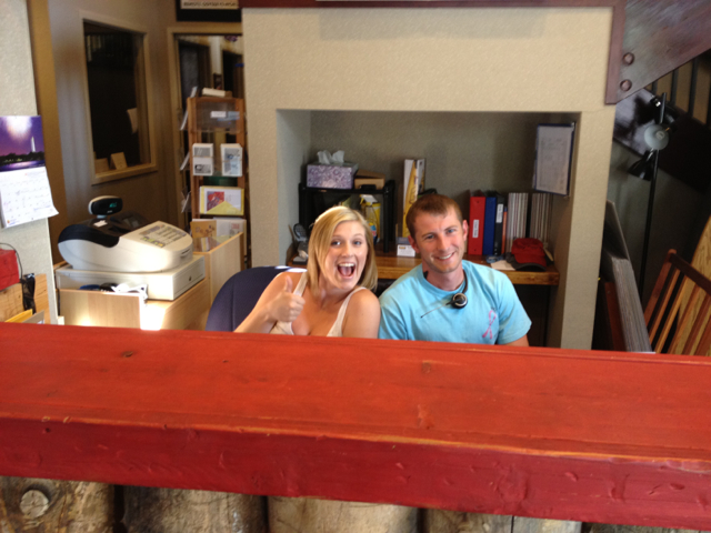
After breakfast I drove down to the Row Adventures office in the city to pick up my bike. Since this was going to be a long and hot day, I arranged to pick up the bike around 7:30 when Libby would be in the office, rather than wait until the rental office opened at 9:30. Libby and David were a great help and I have nothing but good things to say about Row Adventures.
I drove from CDA to Lookout Pass Ski Area (Exit 0 in Montana) to buy my trail pass, then pass and directions in hand, I drove to the East Portal trail head (the top) of the trail.
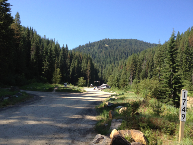
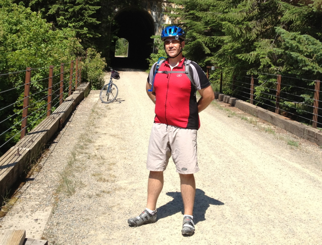
I easily found a parking spot. Despite what I thought was an early start, there were a fair number of vehicles already in the lot, as well as many others getting ready for their ride. I proceeded to remove the bike from my car and prepare it for the ride. The bike I rented was a Hybrid, rather than a Mountain bike. I chose this option since if I were to use one of the organized tours, I would likely want a hybrid for the flat paved trails, and from my research, this trail was expected to be fine. (spoiler, it was fine, but there were stretches where the knobby tires of a mountain bike may have been nice). In total honesty, I did have one issue with the rental bike. When I checked the tire pressure, they were both a little low, and when I pumped up the front tire, the stem broke off in the tube. Conveniently though, I had my tools with me and Row had provided me 2 spare tubes, so I could fix the one I had, and still have a backup if anything occurred on the trail.
While I was prepping my bike, I ended up assisting a few others with theirs (the danger of breaking out a tool box), but this is par for the course in the cycling community. You never pass someone by without determining if they need assistance or not.
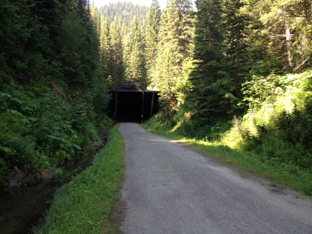
Bike ready, sun screen applied and water topped off, I started for the entrance to the trail. The trail starts off at the mouth of an almost 2 mile long tunnel that has no lighting. I had prepared for this (or so I thought) by bringing with me two different lights. I quickly found upon entering the tunnel that these were far from adequate to the task. I cashed out some Karma though, as one of the groups I had assisted in the parking lot came up ready to go through the tunnel themselves, and they had bright head lights and helmet lights. I trailed along after them through the tunnel and found it to be an interesting (although wet and dirty) experience. I vowed internally to make sure that I look for a group to go through with on the way back.
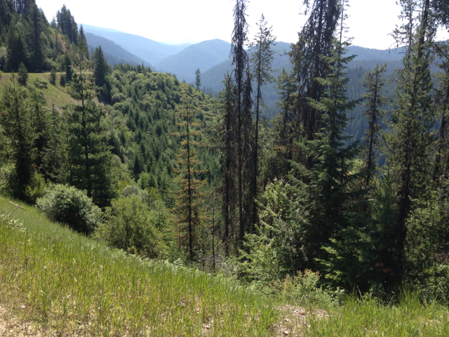
Once through the tunnel, I emerged back into the sunlit world to some of the most beautiful scenery I had seen yet.
Once outside the tunnel, I proceeded down the trail. At this point the trail is actually a fire road, shared with the shuttle buses that ferry riders up from the bottom of the trail, as well as limited parking for trail riders who want to bypass the Taft tunnel. It isn’t the best scenery of the ride, but just looking around, you are surrounded by mountains on all sides, and looking down from the edge you can’t help but be impressed by the views.
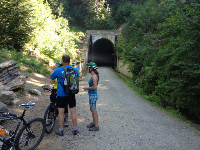
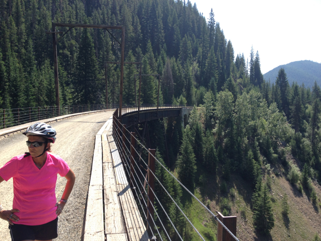
The trail itself goes on for 15 miles. From the East Portal, the trail is almost always descending, with a few places where it ascends slightly before descending again as it bypasses a sealed off tunnel (Closed due to instability from being on a fault line). There are numerous short tunnels on the trail, and several trestle bridges that the riders traverse.
Although I started out riding the trail alone, and in fact rode alone the majority of the time, I did encounter several other riders throughout the ride. This is a slow ride by design, with the emphasis being on viewing the scenery, so the same faces kept appearing at the various stops. I didn’t mention the stops yet. The trail is a ride through the history of the Milwaukee Road between Illinois and Washington. This train route was one of the important early railways, and throughout the trail there are stop points (about 3 per mile) with information about the trains that ran on the tracks, and the building and history of that particular spur.

The trip toward the Pearson trailhead (at the bottom) was as easy as you could ask for. The gravel presented more of a psychological challenge for some riders on the way down, but also serves to provide a crude speed control and a sense of connection that would be lost if the trail were paved. I’m sure that if they thought about it, the families riding with small children would appreciate that a 3% slope if it were paved could result in out of control children careening over the side.
At the half-way point of the trail, there is a fresh water cooler (ice water!) before entering a short tunnel, and a bathroom on the far end of the tunnel. The second half of the trail has many of the same views seen previously, but now if you look back and up, you can see people riding across some of the same trestle bridges that you just passed over. The gravel is much looser and the going a bit harder as a result on this half. I spoke with one of the Trail Marshals and learned that when they went to open the trail at the beginning of the year, there were several 20ft. sink holes on the lower part of the trail that had to be filled in. As a result, the gravel and rock used had not yet been ridden over enough to pack it down. For folks descending, this isn’t too much of a bother. During the ascent, it did present a bit of a challenge, making the riding similar to running in sand. I continued down trail to the end at the Pearson trailhead, where another bathroom awaited, as well as the shuttle buses to ride back to the Taft Tunnel (riders must ride through the tunnel after exiting the buses). Being a he-man stud, I had committed myself to riding back up the 15 miles 1000ft ascent rather than take the easy way. The descent had taken me almost 2 hours, but I had ridden slowly and stopped at most of the information kiosks. I anticipated that the ascent on the loose gravel surface would take me about 2 hours (and I was right).
The ascent was mostly uneventful. One thing to be aware of on this trail is that many (most?) of the people riding down the trail do not ride bikes normally. Add to that the presence of children, and many (I think 8) dark tunnels (all but the taft are fairly short, but one of them does have a turn in it, so the light at the end is not visible) and you have a recipe for possible collisions. By keeping alert, and hollering occasionally when a descender was too occupied looking around at the trees and valleys to notice that they were about to run into you make the ascent mostly uneventful. Unlike on the descent, those who ascend mainly will ascend with the group they came with, so if you came alone, you will ascend alone. There is an advantage to ascending alone. A single rider is much quieter than a group, and by being quiet, I was able to see a large doe at one point but she bolted off when she noticed me. Otherwise, the fauna most seen is a small squirrel looking animal (not a squirrel or chipmunk but similar). If you ride this trail, be especially careful when riding through the tunnels if you ride the trail from Pearson to Taft. Children will steer their bikes right at you when they see your light. Inattentive adults will just not see you.
I made it to the top of the trail at about 3PM ( I forgot when I left that Montana was in Mountain Time, so for me it was 2PM). As I approached the Taft Tunnel, I was planning to wait for the next shuttle bus of riders to arrive so that I could navigate the tunnel in a group. As it turned out, one of the Trail Marshals offered to loan me another light, and even better, as I was waiting in the mouth of the tunnel, another Trail Marshal came up who was riding through himself. His light was dead, so I gave him the light I had borrowed and together we rode through the 2 miles of stygian blackness to the East Portal and my car.
The rest of the day was uneventful. I wiped down the bike before putting it in my car (it was completely mud splattered), drove back to CDA and returned the bike. A shower at the hotel later, and I headed out to Capone’s again for dinner. Normally I would avoid eating at the same place 2 days in a row on travel, but the food was good, the beer cold, and there was still one item on the menu that had been featured on “Diners, Drive-Ins and Dives”, and I was determined to complete that achievement.
